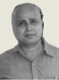
Speaker

Bio
Group Head, Geosciences, Remote Sensing Application area, National Remote Centre , ISRO, Dept of Space and working in the field of remote sensing and GIS application for geosciences. 25 years experience in the field of geological application for mineral, geo-hazards and geo-environment. Held Faculty position in Indian Institute of Remote Sensing (IIRS), Dehradun. Research interest in the field of hyperpspectral and microwave remote sensing. As a member of Disaster Support Centre of ISRO has provided EO based support for all the major geological hazards in the country especially landslides and earthquakes. Member of various national and international committees on space science application in the field of geology. Carried out international assignment on geological mapping for Dubai and its surroundings. Represented ISRO in the international forum on Earth Observation and disaster working group. Visited ITC, Netherlands as research expert for PhD defense. Chaired national & international seminars. Member Secretary for Standing Committee on Geology chaired by Secretary, Mines. ISRO team award winner for contribution in disaster activity. Team leader for the National Geomorphological and Lineament mapping project for the country in association with GSI. Has 90 research paper in the National and International Journals.
Abstract
Satellite remote sensing for mineral Exploration - a Indian perspective
In recent times, satellite technology has been effectively used for geological mapping including mapping of straigraphically or economically significant rock types and also has been used to map regional geological structures. Major strengths of remote sensing data lies in mapping spatial extension of faults known as remobilized zone of concentration of certain deposits such as petroleum or lode type gold deposit associated with shear zones. Present availability of high spatial resolution (less than a meter spatial resolution ) data from Geoeye or high resolution from Indian Remote Sensing Sensors like Cartosat-1,Cartosat-2( having 2.5 meter and one meter spatial resolution) would be suitable for mapping geological structures or surface manifestations of such faults. In addition to standalone use of high resolution imageries, digital elevation data supplemented with high resolution panochromatic data would (for example satellite sensor like Cartosat-1 is capable of deriving digital elevation data based on simultaneous data acquisition by two cameras for same area providing “stereoscopic-set up for elevation derivation).These DEM data supplemented with high resolution data would be suitable for detail structural mapping for mineral exploration. Near surface signatures indicative of mineralization such as buried Paleochannels, geological lineaments covered with sand or similar low loss dielectric medium( i.e. medium characterized low energy loss of radar signal while transmission) can be targeted using microwave sensors from space borne platform or ground based radar instruments. Paleochannels etc. are often regarded as the “redox-fence” and known for concentrating mineralized deposit resulted at the boundary zone of different oxidation-reduction state. In India, similar deposits (e.g. for uranium) are available which is concentrated at buried channel. At present, multi frequency (X,C and L band having wavelength of 3.25 5.6 cm and 23 cm radar images can be acquired from space borne sensors, which can be specifically used for mapping sub surface features(specially L band data), or weak zones significant for mineralization.Unlike multi spectral data collecting spectral information within discrete and broad spectral bands present hyperspectral sensor can collect spectral information with finer and contiguous spectral bands and suitable for delineating target based on “spectral characters”. Hyperspectral remote sensing is regarded as the most authentic remote sensing method for mapping minerals from remote observations and has promising role in mineral exploration. The main basis for spectral characterization of altered rocks/minerals is related to the proven potential of spectral datasets in mineral identification as spectral features are related to atomic process and consistent irrespective of sensor to target distance. Major issue in implementing remotely sensed data from the advanced suit of sensors like hyperspectral, microwave and very high resolution panochromatic sensor is related to the intense tropical weathering under which the rocks of Indian geological province are exposed. In addition to above, availability of desired datasets for specific areas was also limited for various reason. Most of the inaccessible areas of the Indian Geological provinces are either covered with forest or covered with snow. Mineralisation belt of southern peninsular India is intensely weathered or many of the deposits does not have appreciable surface exposures. Another important limiting factor on limited utilisation of remote sensing data in mineral exploration is related to the limitation in scientific understanding on how surface signatures related to spectral, dielectric thermal parameters, would vary near to mineralized zone in comparison to back-ground geological province. Due to the lack of such understanding it is very difficult to establish any quantitative, semi-quantitative even empirical relation between parametric signatures derived from remote sensing data with the geochemical and geological datasets related to the deposits. The aforesaid factors contribute negatively in the implementation of remote sensing technology in resource mapping. In this background; there are several isolated yet important efforts have been made for mapping different mineral deposits. In the paper, attempt has been made to discuss the those attempts under the light of present state of art of the technology and also discussed future scope of better usage of remote sensing data in mineral targeting in India.