|

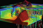
The world is becoming more and more interested in virtual modeling. This trend coincides with the need to better understand the spatially related problems and issues visually. The increased availability of high-resolution satellite images and aerial photography in support of detailed terrain surface elevation models assists urban planners and municipal managers to create a model and visualize the urban space in three dimensions. 3D visualization models have a variety of applications in geography and urban studies. Accurate cartographic feature extraction, map updating, digital city models and 3D city models in urban areas are essential for many applications, such as military operations, disaster management, mapping of buildings and their heights, simulation of new buildings, updating and keeping cadastral databases current, change detection and virtual reality. 3D models can be used as a user-friendly interface for querying the urban environment as a Geographic Information Systems (GIS), for hyper-linking Web-based information, for visualizing model results, and for accessing functional simulation models. By combining the described process with interpreted seismic data in the vertical dimension, a greater understanding of the relationship between surface and subsurface structures can be achieved at both basin and prospect scale. This understanding is further enhanced when it is viewed in an immersive 3D visualization environment.
|